

If you fish around Kennewick, Richland, or Pasco, the Columbia River system gives you several very different options within the Tri-Cities area. Lake Wallula supports bass, walleye, catfish, salmon, steelhead, sturgeon, and other species, while nearby ponds, river-access sites, and smaller lakes add shore and boat opportunities. The key is matching your spot, season, and gear to current Washington fishing rules.
Quick Answer
For Tri-Cities fishing, start with Lake Wallula and the Columbia River around Kennewick, Richland, and Pasco. Smallmouth bass, walleye, channel catfish, salmon, and other species are available, but seasons and retention rules vary. Check WDFW regulations and emergency changes before every trip, especially for salmon and steelhead.
Key Takeaways
- Lake Wallula is the main Tri-Cities fishery and includes Columbia River water from McNary Dam upstream toward Priest Rapids Dam plus part of the lower Snake River.
- Smallmouth bass, walleye, channel catfish, salmon, steelhead, sturgeon, crappie, perch, and other species occur in the system.
- Columbia Park, Ringold Springs, Dalton Lake, and Yakima River shoreline access near Benton City give you additional options.
- Lake Wallula does not allow two-pole fishing, and salmon or steelhead rules can change during the season.
- The Florida and Michigan fishing maps included later in this roundup are travel products, not maps of the Tri-Cities.
Affiliate disclosure: This article contains Amazon affiliate links. If you make a qualifying purchase through one of those links, we may earn a referral commission at no additional cost to you.
Best Fishing Areas Around The Tri-Cities
The Washington Department of Fish and Wildlife identifies Lake Wallula as the large reservoir that extends from McNary Dam upstream to Priest Rapids Dam on the Columbia River and to Ice Harbor Dam on the Snake River. That puts much of the Kennewick-Richland-Pasco waterfront inside one connected fishery.
|
Area |
Best Use |
What To Know |
|---|---|---|
|
Lake Wallula / Columbia River |
Boat and shore fishing for multiple species |
Good shoreline access and numerous launches; smallmouth bass, walleye, channel catfish, salmon, steelhead, sturgeon, crappie, perch, and other fish occur here. Two-pole fishing is not allowed. |
|
Columbia Park, Kennewick |
Convenient urban river access |
The City of Kennewick lists fishing and boat launches among the park’s amenities. It is useful when you want river access without traveling far outside the Tri-Cities. |
|
Ringold Springs |
Upper Columbia access and boat launching |
WDFW lists the access area as open year-round with an unimproved ramp. Fishery seasons and retention rules are separate from access-site hours, so check current rules before fishing. |
|
Dalton Lake |
Trout, bass, perch, crappie, and bullhead |
This lake northeast of Ice Harbor Dam is open year-round and receives catchable rainbow trout during late winter and spring. Public access includes a boat launch. |
|
Yakima River near Benton City |
Shoreline fishing |
The Benton City Wildlife Area Unit provides Yakima River frontage and shoreline fishing. Always check the current river-specific regulations before targeting or retaining fish. |
|
Columbia Park Pond |
Restricted-access pond fishing |
This is not a general unrestricted fishing pond. WDFW applies special eligibility rules, so confirm that you qualify before fishing there. |
WDFW lists Lake Wallula at more than 26,000 acres, with good shoreline access and a long list of warmwater and migratory fish species.
What To Fish For By Season
There is no single “best month” for every Tri-Cities species. Local fishing changes as water temperature, river flow, spawning behavior, and salmon runs change.
|
Season |
Good Opportunities |
Approach |
|---|---|---|
|
Spring |
Bass, walleye, catfish, stocked trout at selected lakes |
Watch warming shallows, rocky structure, points, and current edges. WDFW shows bass activity improving as water warms, while Dalton Lake receives trout plants in late winter and spring. |
|
Summer |
Walleye, bass, perch, catfish and season-dependent salmon opportunities |
Early morning and evening can be productive for bass. WDFW rates much of the summer well for Lake Wallula walleye, although the hottest periods can slow activity. |
|
Fall |
Bass, walleye and season-dependent salmon fishing |
Cooling water can improve warmwater fishing. Hanford Reach salmon opportunities can also draw anglers, but salmon seasons and limits are actively managed and can change in-season. |
|
Winter |
Walleye and selected year-round fisheries |
Expect slower fish and deeper presentations. WDFW notes that walleye can still be caught in deeper water during winter even when bass become harder to target. |
Warning: Do not rely on an old article, screenshot, or paper map for current salmon, steelhead, or sturgeon rules. Washington’s 2026-2027 fishing regulations are currently in effect, but emergency rules can change seasons, retention limits, or open areas during the year. Check the WDFW regulations page and emergency fishing rules immediately before your trip.
Pro Tip: Treat a fishing map as a planning tool. Mark ramps, shoreline access, points, current seams, and backup locations before leaving home, then use current GPS/sonar, visible conditions, and official regulations once you are on the water.
License And Boating Basics
Washington anglers age 16 and older generally need an appropriate fishing license. If you fish for salmon, steelhead, sturgeon, halibut, or Puget Sound Dungeness crab, additional catch-record requirements apply. WDFW’s current licensing information is available on its fishing license page.
If you use a boat, kayak, canoe, or paddleboard, Washington State Parks says the vessel must carry at least one properly fitted U.S. Coast Guard-approved life jacket for each person aboard. Additional requirements apply to children, personal watercraft, towed participants, and many vessels 16 feet or longer.
Note: Access being open does not automatically mean every species is open for retention. An access area, boat ramp, or shoreline may remain available while a particular salmon, steelhead, or sturgeon season is closed.
Top Picks
The products below were included in the original roundup, so they are retained here. However, the three fishing maps are not Tri-Cities maps. They make sense only for anglers traveling to those specific destinations. The two smaller accessories have broader everyday use.
|
Category |
Product |
Best Use |
|---|---|---|
|
🏆 Florida Keys Travel Map |
Seven Mile Bridge to Conch Key |
|
|
💼 South Florida Coastal Map |
Card Sound to Miami |
|
|
🎯 Michigan Lake Map |
Lake Gogebic travel |
|
|
🚀 Utility Accessory |
Keys or small tools |
|
|
🎨 Fishing-Themed Key |
Key identification and gifts |
How We Chose
For local Tri-Cities guidance, accuracy and current regulations matter more than marketplace popularity, so the fishing-location advice in this guide is based on WDFW and public access information. For the retained commercial products, usefulness depends on location, portability, construction, and whether the item solves a real problem. The three destination maps are evaluated only for the waters they actually cover—not as Tri-Cities maps.
Seven Mile Map
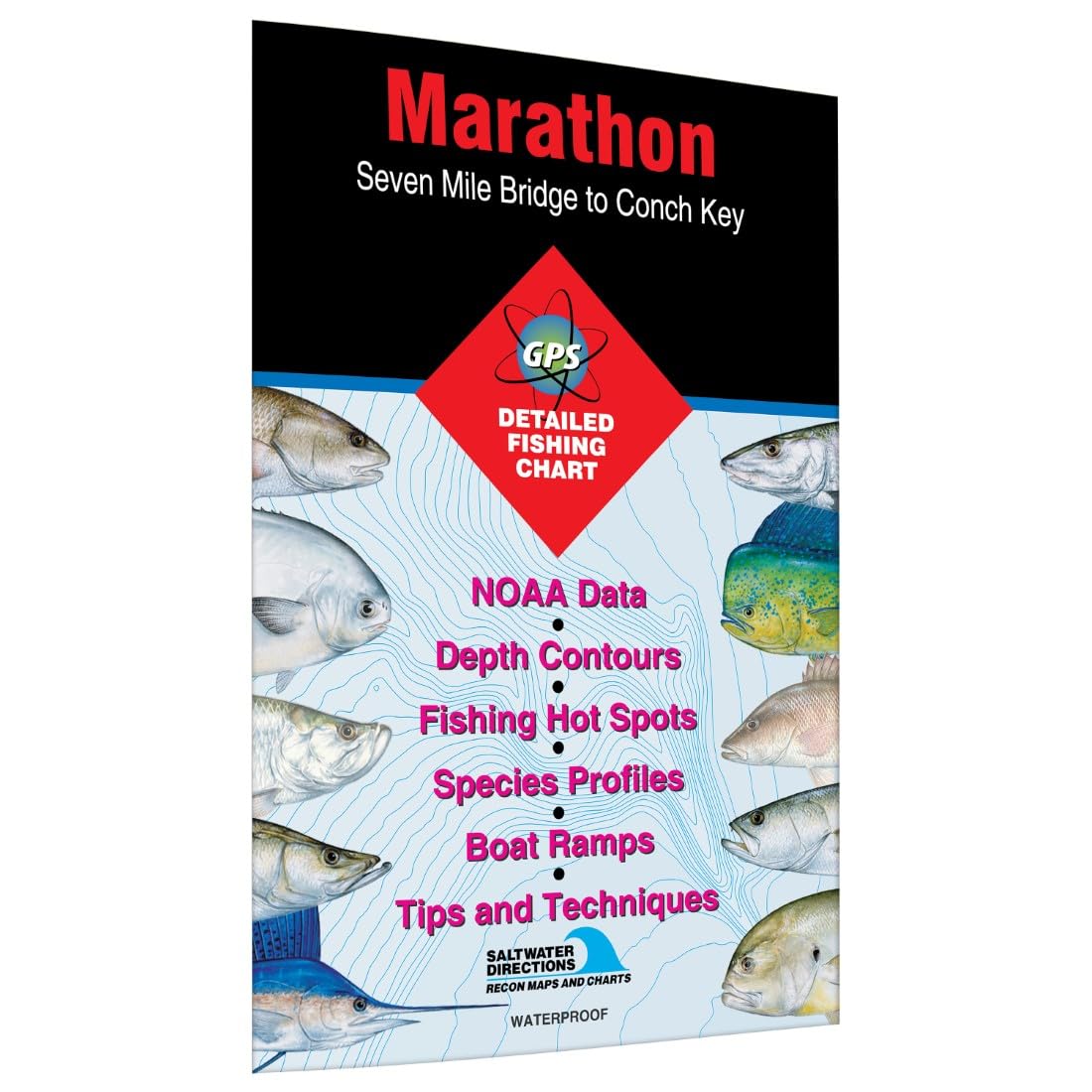
This is a Florida Keys fishing map, not a Tri-Cities map. Fishing Hot Spots identifies it as covering the area from Seven Mile Bridge to Conch Key around Marathon, Florida. It includes fishing information, GPS information, access locations, marked fishing areas, and marina information for that specific region.
If you are planning a Florida Keys trip, the focused geographic coverage can make it useful for pre-trip research and on-water reference. If you are fishing Kennewick, Richland, or Pasco, choose local WDFW resources instead.
What People Say
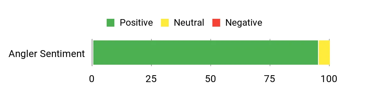
The supplied source characterized buyer sentiment as positive, especially around map detail and print quality. Marketplace ratings and review totals change over time, so they should not be treated as permanent specifications.
Overall Sentiment: Positive in the supplied review summary; current marketplace feedback may change.
Long-Term Value
The map has lasting value if you repeatedly fish or visit the Marathon and Middle Keys area. Its value is much lower for anglers who rarely travel to South Florida.
Return On Investment
Rather than promising better catches, the practical benefit is faster trip planning. A location-specific map can help you organize access points, potential fishing areas, and backup locations before a trip.
Situational Benefits
|
Situation |
How It Helps |
|---|---|
|
Scouting New Areas |
Lets you study the Seven Mile Bridge-to-Conch Key area before arriving and identify places that deserve a closer look. |
|
Shore Fishing |
Access information can help narrow down places to investigate, subject to current property and fishing rules. |
|
Boat Trips |
Provides a regional overview that can complement proper marine navigation equipment and current local information. |
|
Trip Planning At Home |
Useful for learning the relationship between fishing areas, access locations, and the surrounding Keys before travel. |
Versatility
It works best as a Florida Keys planning reference rather than a general fishing map. Its narrow geographic focus is a strength only when that is where you plan to fish.
Safety
Use this fishing map as a planning aid, not as your sole source of marine navigation information. Conditions, channels, hazards, regulations, and access can change.
Durability
A map used around water benefits from dry storage or a protective sleeve. Keeping it folded correctly and away from prolonged moisture will extend its usable life.
Problem Solving
It solves a specific problem: understanding the Marathon-to-Conch Key fishing area without relying only on a small phone screen.
Indoor/Outdoor Use
You can study it at home during trip planning and carry it on the water as a secondary reference.
Key Benefits
- Focused coverage from Seven Mile Bridge to Conch Key
- Fishing and access information for a specific Florida Keys area
- Useful paper reference for travel planning
Marketplace rating: Dynamic; check the live listing for the current rating and review count.
Ximimark Reel
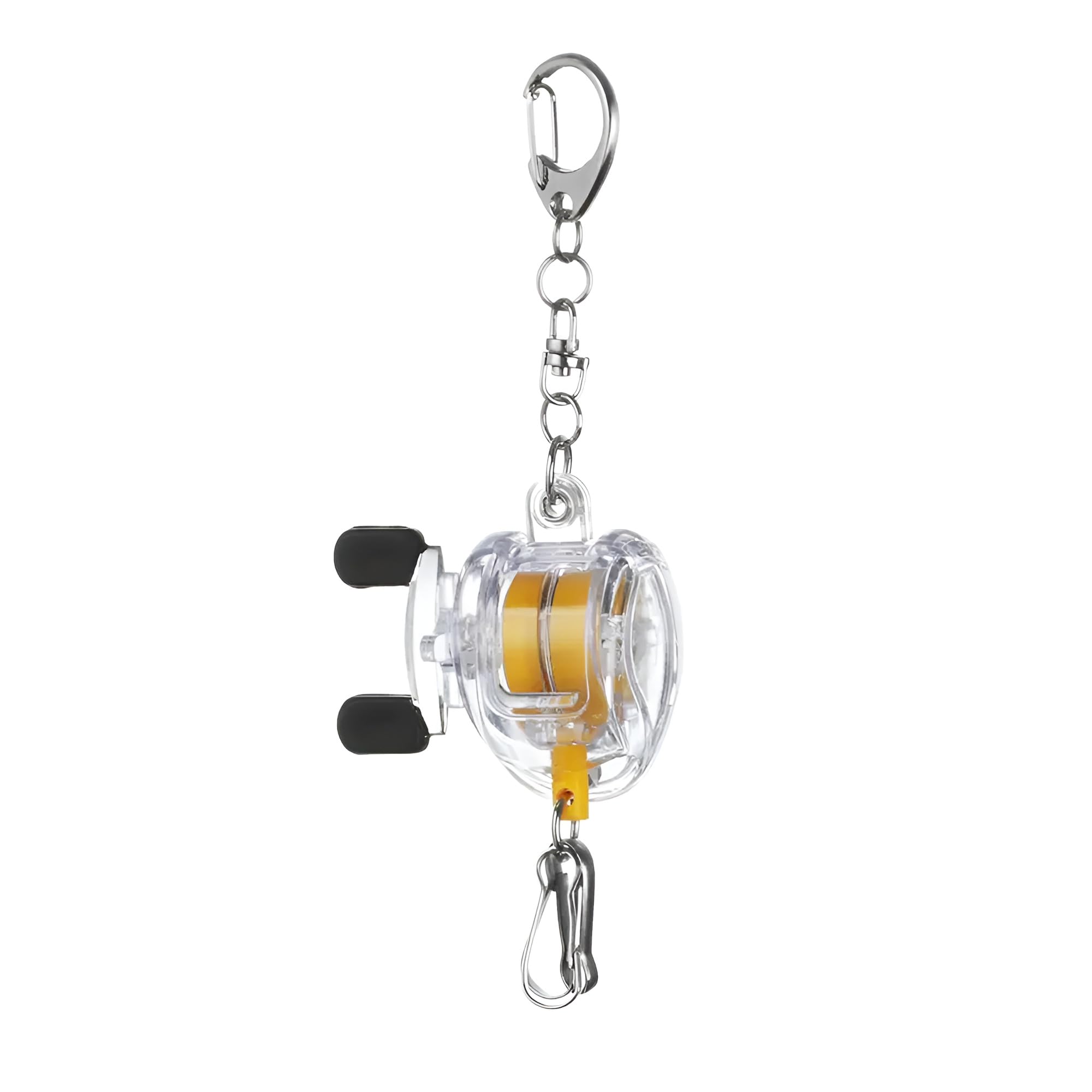
This compact retractable reel is more broadly useful to a Tri-Cities angler than the out-of-area maps because it can keep keys, a badge, or another lightweight item tethered and accessible. Clip-on storage is convenient around a boat, tackle area, workshop, or everyday carry setup.
Its fishing-reel styling makes it more interesting than a plain badge reel, but treat it as a small accessory rather than critical fishing equipment.
What People Say
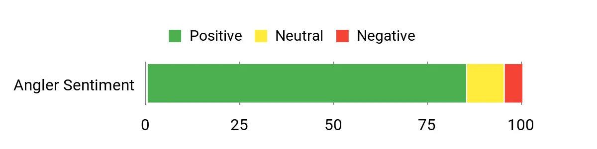
The supplied review summary describes the product as cute, functional, and giftable, with users appreciating the miniature fishing-reel appearance and retractable design. Because marketplace reviews change, current ratings should be checked on the live product page rather than permanently hard-coded.
Overall Sentiment: Positive in the supplied review summary.
Long-Term Value
The main long-term benefit is organizational: keeping a frequently used key or small item attached to your clothing or gear instead of loose in a pocket or bag.
Return On Investment
The value is convenience rather than measurable financial return. It makes the most sense if you regularly use a retractable key or badge tether.
Situational Benefits
|
Situation |
How It Helps |
|---|---|
|
Everyday Carry |
Keeps a key or badge within reach without repeatedly searching a pocket. |
|
On The Boat |
Can keep a suitable lightweight item tethered to a belt, bag, or compatible attachment point. |
|
Workshops |
Useful for identification cards or other small items you retrieve often. |
|
Gifts |
The fishing-reel design makes it a simple themed gift for anglers. |
Versatility
It can serve as a key holder, badge reel, or tether for another lightweight item that fits the attachment hardware.
Safety
Keep retractable cords away from moving machinery, propellers, hooks, and other snag hazards. Do not use a small accessory tether as a substitute for purpose-built safety equipment.
Durability
The supplied product information describes steel-wire construction and a metal clip. Saltwater, dirt, and repeated wet storage can still shorten the life of small metal hardware.
Problem Solving
It helps prevent frequently used small items from disappearing into a tackle bag, vehicle console, or pocket.
Indoor/Outdoor Use
It can work indoors or outdoors, but drying metal components after wet use is sensible.
Benefits
- Quick access to keys or lightweight items
- Fishing-themed retractable design
- Compact attachment for belts, bags, or lanyards
Marketplace rating: Dynamic; check the live listing for the current rating and review count.
Lucky Line Key
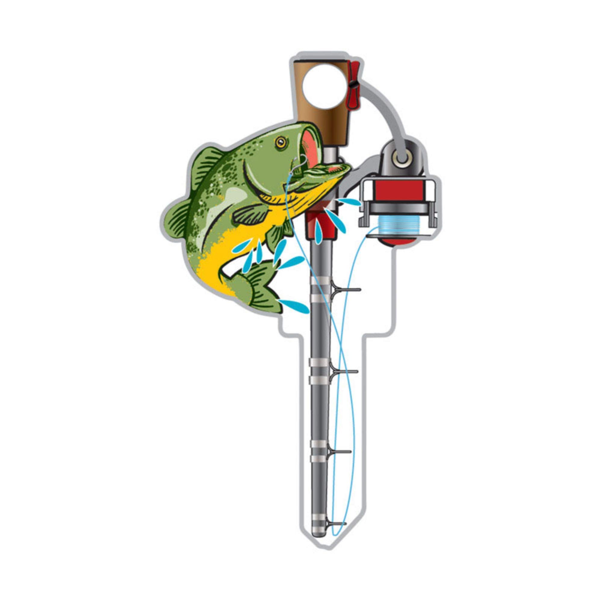
This fishing-themed house-key blank gives an everyday key an obvious visual identity. The SC1 version is intended for compatible Schlage-style applications, so match the blank to your existing key before having it cut.
It is more of a practical personalization item than fishing gear, but the bright design can make a frequently used key easier to identify on a crowded ring.
What People Say
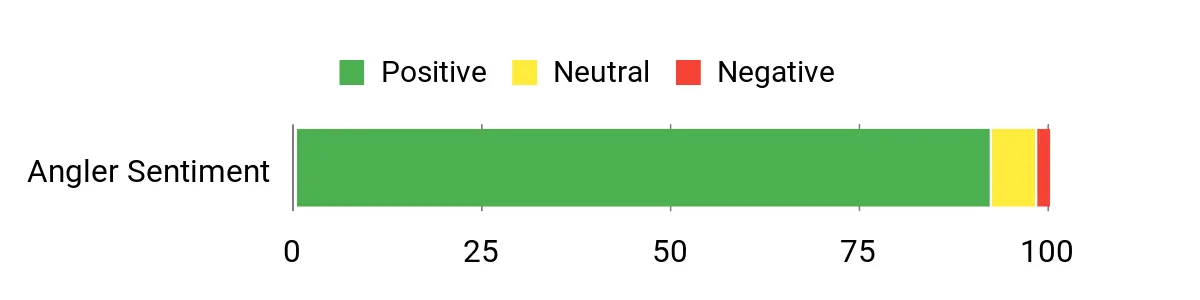
The supplied review summary says buyers like the colorful design, solid feel, and gift potential. As with any marketplace product, review counts and average ratings can change after publication.
Overall Sentiment: Positive in the supplied review summary.
Long-Term Value
A distinctive key can remain useful for years if the blank matches your lock and the finish holds up to everyday handling.
Return On Investment
The value is simple identification and personalization, not a financial return. It can be worthwhile if color and shape help you distinguish one key quickly.
Situational Benefits
|
Situation |
How It Helps |
|---|---|
|
Everyday Use |
Makes a compatible house or office key easier to recognize on a crowded key ring. |
|
Gifts |
Offers a small functional gift option for someone who enjoys fishing. |
|
Workshops and Sheds |
Can visually distinguish one compatible lock key from several plain blanks. |
|
Backups |
A distinct design makes a spare key easier to identify. |
Versatility
Use it as a primary compatible key, spare, themed gift, or visual identifier.
Safety
Have the blank matched and cut correctly for your lock. Forcing an incompatible or poorly cut key can damage the key or lock.
Durability
The supplied listing information describes a metal key blank with a decorative coated design intended for repeated handling.
Problem Solving
The bright fishing design makes the key visually different from ordinary plain blanks, reducing wrong-key fumbling.
Indoor/Outdoor Use
It is suitable for ordinary key use indoors or outdoors, although abrasive conditions and repeated water exposure can wear decorative finishes over time.
Key Benefits
- Easy-to-identify fishing design
- Functional key blank rather than a purely decorative charm
- Useful as a themed spare or gift when the keyway matches
Marketplace rating: Dynamic; check the live listing for the current rating and review count.
Biscayne Map
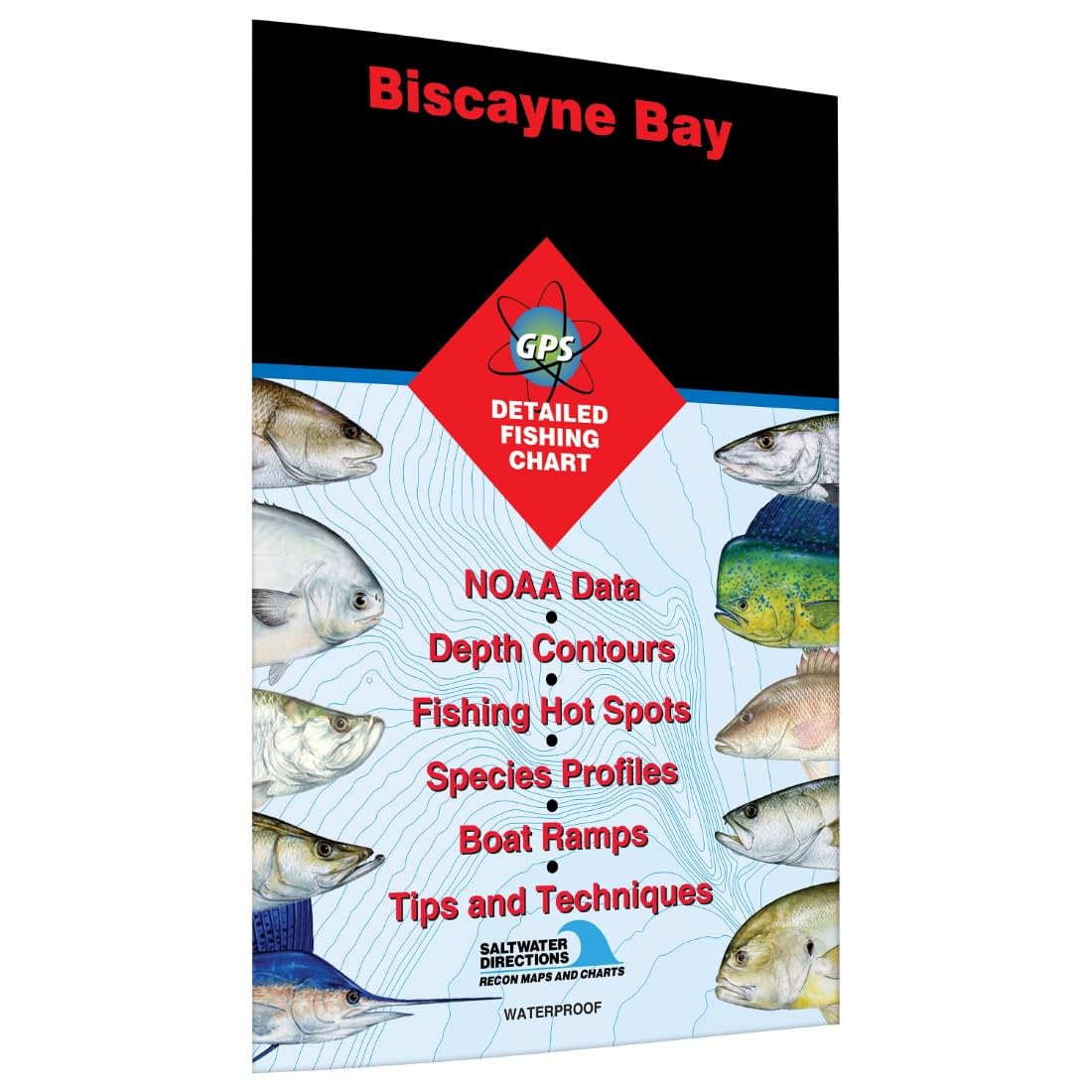
This is a South Florida saltwater fishing map covering Biscayne Bay from Card Sound toward Miami. Fishing Hot Spots describes it as including GPS information, access locations, marked fishing areas, marina information, and featured-species guidance.
It can be useful when planning a South Florida fishing trip, but it does not provide fishing information for Kennewick, Richland, Pasco, Lake Wallula, or the Hanford Reach.
What People Say
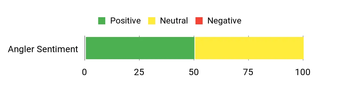
The supplied article had limited marketplace-feedback data for this map. Rather than infer customer sentiment from the product category, it is more accurate to judge the map by its verified geographic coverage and listed features.
Overall Sentiment: Insufficient stable review data to characterize confidently.
Long-Term Value
The chart has repeat value for anglers who regularly fish Biscayne Bay or return to the Miami area. It has little practical value for local Tri-Cities fishing.
Return On Investment
The realistic benefit is planning convenience for the exact region covered. It should not be presented as guaranteeing better catches or lower fuel use.
Situational Benefits
|
Situation |
How It Helps |
|---|---|
|
Coastal Runs |
Provides a broad fishing-oriented reference for the Biscayne Bay region when used alongside appropriate navigation tools. |
|
Reef And Structure Fishing |
Marked fishing areas and reef information can help with pre-trip research. |
|
Shore Access Planning |
Listed access locations can help you identify areas to research before arrival. |
|
Trip Prep At Home |
Helps visualize the relationship between Miami, Card Sound, access points, and fishing areas. |
Versatility
The map is useful for Biscayne Bay travel planning and as a supplemental paper reference, but its geographic scope is intentionally narrow.
Safety
Do not substitute a recreational fishing map for current marine navigation information, weather awareness, local notices, or sound boating judgment.
Durability
Protect any paper or folded chart from repeated moisture, sharp folds, and prolonged sun exposure unless the manufacturer specifically identifies the material as waterproof.
Problem Solving
It provides a larger-format regional overview that can be easier to study than repeatedly zooming around a phone screen.
Indoor/Outdoor Use
It works for pre-trip planning indoors and as a supplemental reference while traveling or fishing.
Key Benefits
- Covers Biscayne Bay from Card Sound toward Miami
- Includes fishing-oriented access and location information
- Useful supplemental paper reference for South Florida trips
Marketplace rating: Dynamic or unavailable; check the live listing for current customer feedback.
Gogebic Map

This map covers Lake Gogebic in Michigan’s Upper Peninsula, not Washington. Fishing Hot Spots identifies Lake Gogebic as a walleye-focused fishery with smallmouth bass, perch, sucker, and cisco also featured on the map.
For an angler planning a Lake Gogebic trip, its lake profile, fishing information, access directions, and marked fishing areas can be useful. For Tri-Cities fishing, use local WDFW information instead.
What People Say
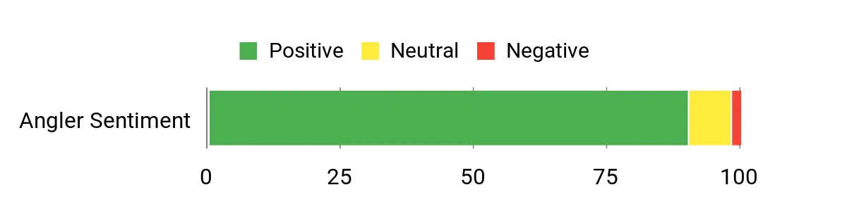
The supplied source summarized buyer response as positive for clarity, print quality, and trip planning. Current ratings and review counts are marketplace data and can change after publication.
Overall Sentiment: Positive in the supplied review summary.
Long-Term Value
The map makes the most sense for anglers who return to Lake Gogebic and want a reusable large-format lake reference.
Return On Investment
The practical payoff is planning convenience and a clearer overview of the lake—not a guaranteed increase in catch rate.
Situational Benefits
|
Situation |
How It Helps |
|---|---|
|
Annual Lake Trips |
Helps returning anglers refresh their memory of lake features and access locations. |
|
Shore Fishing |
Access information can help identify areas worth researching before a trip. |
|
Boat Outings |
Provides a broad lake overview to complement appropriate electronic navigation and current conditions. |
|
Pre-Trip Prep |
Useful for learning the lake’s shape and comparing fishing areas before arrival. |
Versatility
Use it for detailed trip planning, sharing fishing areas with companions, or keeping a paper overview available alongside electronics.
Safety
Do not depend on a fishing map alone for safe boat navigation. Water levels, hazards, weather, local rules, and navigation information can change.
Durability
Frequent handling around water calls for careful storage. A sleeve or map case can help protect folds, printing, and edges.
Problem Solving
The map gives you a whole-lake view without repeatedly changing zoom levels on a small display.
Indoor/Outdoor Use
Study it indoors during planning and carry it outdoors as a supplemental fishing reference.
Key Benefits
- Lake-specific information for Lake Gogebic, Michigan
- Featured fishing areas and access information
- Useful paper overview for repeat Lake Gogebic trips
Marketplace rating: Dynamic; check the live listing for the current rating and review count.
Frequently Asked Questions
What are the best seasonal fishing opportunities around the Tri-Cities?
Spring warming can improve bass and catfish activity, while walleye can be productive through much of the year and often fish well during summer outside the hottest lulls. Fall cooling can improve bass and walleye activity, and salmon seasons can create major opportunities in the Columbia and Hanford Reach. Because salmon and steelhead rules change in-season, confirm WDFW regulations before every trip.
Do I need paper maps or electronics?
They serve different purposes. A paper map gives you a large overview for planning and works without battery power. GPS, sonar, and current digital information are better for real-time position, depth, and updated conditions. Neither replaces current regulations or safe boating judgment, so combining planning tools usually works best.
What gear and accessories should I pack?
Match tackle to the species you intend to target, and add polarized glasses, pliers, spare terminal tackle, water, sun protection, and weather-appropriate clothing. Boaters should carry the required Coast Guard-approved PFDs. Bring your required fishing license and any catch record documentation that applies to your target species.
Can I use two fishing poles on Lake Wallula?
No. WDFW currently lists two-pole fishing as not allowed on Lake Wallula. Always verify the water-specific regulation before fishing because rules differ between lakes and river sections.
Is Columbia Park Pond open to everyone?
No. WDFW applies special eligibility restrictions at Columbia Park Pond. Check the current WDFW listing before fishing there rather than assuming it operates like an unrestricted public lake.
Angler Preferences
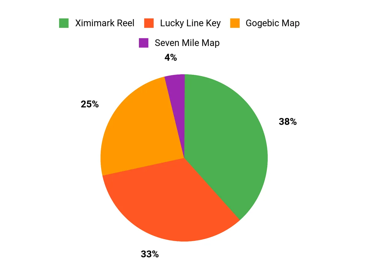
For a Tri-Cities angler, local accuracy should come before product novelty. Start with WDFW’s Lake Wallula, regulations, and access information. The Seven Mile, Biscayne, and Gogebic maps only make sense when you are traveling to those destinations. The Ximimark Reel and Lucky Line Key are optional convenience items rather than essential fishing equipment.
Wrapping Up
The best Tri-Cities fishing plan starts with the water you actually intend to fish. Lake Wallula and the Columbia River give you the broadest local mix of species and access, while Ringold, Dalton Lake, Columbia Park, and Yakima River frontage add useful alternatives. Check the current WDFW rules before every trip, especially when targeting salmon, steelhead, or sturgeon, and treat any fishing map as a planning aid rather than a guarantee of access, safe navigation, or fishing success.
| Product Name | Image | Rating | Material | Dimensions | Special Highlights |
|---|---|---|---|---|---|
| Marathon Seven Mile Bridge to Conch Key Fishing Map |
|
Dynamic — see current listing | Printed fishing map | Varies by edition/listing |
|
| Ximimark 1 pcs Compact Retractable Fishing Reel Keychain |
|
Dynamic — see current listing | Steel-wire component per supplied listing | See current listing |
|
| Lucky Line Key Shapes, FISHING, House Key Blank |
|
Dynamic — see current listing | Metal key blank with decorative finish | See current listing |
|
| Biscayne Bay – Card Sound to Miami |
|
Dynamic or unavailable | Printed fishing map | Varies by edition/listing |
|
| Gogebic Fishing Map, Lake |
|
Dynamic — see current listing | Printed fishing map | Varies by edition/listing |
|
Sources
- Washington Department of Fish & Wildlife — Lake Wallula — local species, shoreline access, launches, seasonal prospects, and two-pole restriction.
- Washington Department of Fish & Wildlife — Fishing Regulations — current statewide regulations and the 2026-2027 sport-fishing rules.
- Washington Department of Fish & Wildlife — Emergency Fishing Rules — in-season closures, openings, and regulation changes.
- Washington Department of Fish & Wildlife — Fishing Licenses — license and catch-record requirements.
- Washington State Parks — Wear a Life Jacket — Washington PFD requirements and boating-safety guidance.
- Washington Department of Fish & Wildlife — Ringold Springs — access status, ramp, parking, and site information.
This Roundup is reader-supported. When you click through links we may earn a referral commission on qualifying purchases.